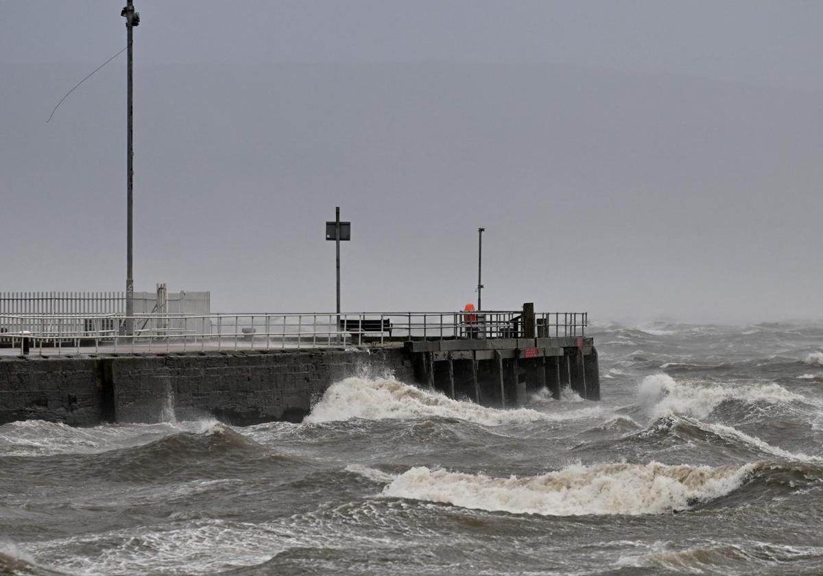
Eowyn, the 'superstorm', arrives in Spain bringing hurricane-force winds up to 120 km/h
The front will enter through Galicia and extend towards the central peninsula, causing strong winds and coastal waves
J. Varela
Friday, 24 January 2025, 15:51
Hurricane-force winds and umbrellas will continue to dominate the scene in Spain. After a week of instability and dropping temperatures, a new 'superstorm' is set to bring very strong and even hurricane-force winds along with widespread rain across much of the Peninsula and the Balearic Islands, according to the forecast by the State Meteorological Agency (AEMET). The storm 'Éowyn', which has already caused significant damage in the UK and Ireland with winds reaching up to 160 km/h, will also bring abundant rain throughout the country, very strong winds, and a significant maritime storm starting this Friday, especially in Galicia, where it will enter the Peninsula.
Wind gusts, particularly in Galicia and the Cantabrian communities, will exceed 100 kilometres per hour (km/h), reaching up to 120 km/h in some areas, leading to a maritime storm with waves up to six metres high. Additionally, the 'superstorm' will be accompanied by heavy rainfall. The rest of the Peninsula may also experience rain, but the situation will worsen with the arrival of the weekend.
Saturday will bring intense rain again in Galicia, and the front will move from west to east, though not as forcefully. In the Mediterranean area, rain will be light and scattered. A noticeable drop in temperatures will occur, leading to snowfall at altitudes between 1,400 and 1,800 metres, although in the Cantabrian Mountains, the snow level will eventually drop to around 1,100 metres.
Hurricane-force winds up to 120 km/h
The front associated with the new storm will reach the northwest of the peninsula on Sunday after bringing rain to Galicia, where there may be storms that will be abundant in this region and may be accompanied by thunder. The rest of the Peninsula will also see rain, though less so in the Mediterranean, and the snow level will rise a few metres. What will be noticeable on Sunday are the south and southwest winds, which will gain strength as the day progresses. There will be very strong gusts in the north and east of the peninsula, even reaching hurricane force, with winds exceeding 120 km/h in some parts of the far north. Therefore, special caution is advised in high mountain areas and coastal zones such as capes and very open coastal areas.
The most challenging day of this 'superstorm' will be Monday, when strong winds will spread to the rest of the Peninsula, causing a significant maritime storm along much of our coasts and rain across almost the entire peninsular territory. Rain will be abundant again in Galicia and throughout the Cantabrian and northwestern areas, as well as in the north of Cáceres and the south of Salamanca and Ávila. Precipitation will also be noticeable in parts of Western Andalusia and western Castilla-La Mancha.
South and southwest winds will cause temperatures to rise, reaching around 20°C in the Cantabrian region and the city of Valencia, and up to 25°C in the Mediterranean on a day that will nonetheless be unpleasant due to the wind.
Tuesday will be very different, with a thermal drop across the country causing precipitation in the far north and mountainous areas of the interior peninsula, where the drop in temperatures could turn them into snow.